Alberta government releases Fort McMurray fire damage surveillance app
May 16, 2016 by The Canadian Press
Print this page Share
EDMONTON – The Alberta government has released an app that will give Fort McMurray residents a good look at their properties.
A message from Municipal Affairs Minister Danielle Larivee warns that viewing the satellite images may be traumatic, and the number for Alberta’s Mental Health Help Line is included in her news release.
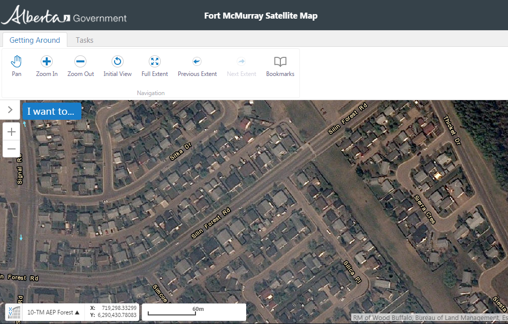
Albertans can use an online mapping application to survey damage in Fort McMurray
Larivee says the maps are intended to provide a high-level satellite overview of the status of the city following the devastating wildfires, however, she cautions that structures that appear to be standing should not be considered undamaged.
Anyone wanting to view the satellite images must first click on a link acknowledging that they have read and understand the terms of use agreement on the government website. [To properly access the map, use this exact URL without altering: https://cdn.albertamapservices.ca/FortMcMurray ]
Larivee says that having been through a devastating fire and evacuation herself five years ago in Slave Lake, she knows how stressful it can be to wait for updates on which homes have been lost.
The minister says higher-resolution images will be released soon that should provide a sufficient level of detail to assist property owners with insurance claims and other recovery actions.
Reminder – the re-entry plan (including estimated date of return) will be announced within the next week and a half. #ymm #ymmfire
— rmwoodbuffalo (@RMWoodBuffalo) May 16, 2016
May 15, 7:15 p.m. – A message from Bob Couture #ymm #ymmfire #fortmacfire #rmwb pic.twitter.com/qIzY3qAvIO
— rmwoodbuffalo (@RMWoodBuffalo) May 16, 2016
Air quality in #ymm is at a high health risk and expected to worsen overnight. https://t.co/rNvsCNj78T #ymmfire pic.twitter.com/HYUbjL3Byy
— rmwoodbuffalo (@RMWoodBuffalo) May 16, 2016
Have your say: